Today’s guest post on the importance of ocean science comes from Nancy Barr of the Monterey Bay Aquarium Research Institute (MBARI), our partner institution.

The casual observer of the ocean might notice day-to-day changes in the waves and currents, or in the water’s color or smell. But how do we know what is going on far below the surface, if we are not there to observe it?
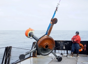
One key focus of MBARI technology development is to create a “persistent presence”—being where changes are taking place, as they happen. It means placing instrumentation in the deep ocean for extended periods of time, instead of relying on the occasional research cruise to make observations and collect data.
Tracking seafloor movement
Sediment moves from the continents into the deep sea both gradually, and in large bursts. This movement plays an important role in providing nutrition to deep-sea organisms. But it can also harm seafloor infrastructure, like underwater Internet cables—and it could possibly trigger geohazards like tsunamis.
MBARI engineers and scientists devised several instruments to record sediment-moving events as they happen. For the past two years, MBARI scientist Charlie Paull and an international research team have been monitoring movement in Monterey Canyon with a suite of instruments and sensors. The effort proved its worth in 2016, when the instruments detected a movement so strong, it swept a large volume of sediment down the canyon—carrying a one-ton steel tripod more than 3 miles down the canyon and burying it deep in the mud.
Listening to the bay

MBARI scientists are now studying the soundscape of the Monterey Bay. To listen, they’re using a sensitive hydrophone placed at our cabled observatory, some 18 miles offshore and a half-mile deep. The hydrophone can pick up sounds out of the range of human hearing. And, because of its connection to the observatory, it can send signals back to shore in real-time.
This data stream signals which whale species frequent the bay and when they pass through. Loud man-made sounds have been detected too, including the motors of container ships and explosions fishermen set off to scare seals and sea lions away from their catch.
The sounds of Monterey Bay, recorded with this remarkable instrument, are available online and have been used in a wide range of educational programs.
Food fluctuations in the abyss
Farther offshore, another long-term monitoring program provides insights into how food moves from the ocean’s surface to the animals living at abyssal depths—an important piece of Earth’s carbon-cycle puzzle.
The MBARI Benthic Rover crawled the seafloor for more than a year at a site known as Station M, 137 miles off the California coast and 2.5 miles deep. The rover—together with a suite of cameras, sensors and other instruments—reveals a life of feast or famine in the deep sea. Animals on the seafloor rely on the rain of marine snow—bits of decaying animals and algae—for food. Warmer waters, increased acidity, and reduced upwelling can affect that steady food supply, or occasionally combine to create a bloom of life at the surface, which sends a large burst of food to the depths.
The ocean’s changing chemistry and temperature may mean a less reliable deep-sea food delivery service. Long-term monitoring of this site provides insight into how climate change is affecting life in the deepest parts of the ocean.
A remote area feeling the effects of climate change

In Antarctica, our technology is part of a much larger project related to climate change.
MBARI researchers have placed sensors on floats in the Southern Ocean. These sensors record the water’s chemical properties in the upper part of the ocean, then transmit the data back to shore via satellite. The floats collect data 24 hours a day in this remote, inhospitable location, where it would not be feasible to send humans on a regular basis. The seas are often stormy or can be partly covered by ice, and ships need to travel long distances to get there.
Information gathered from this project will help researchers better understand the inner workings of the Southern Ocean and how it impacts Earth’s climate and biosphere. Students are following along with an “adopt a float” program, and a life-size float model that can be brought to their classroom.
Large movements of seafloor sediment, shipping and whale sounds, pulses of food to the deep sea, and chemical changes in the Southern Ocean would all be invisible to our eyes and silent to our ears if we couldn’t use technology to be there—where the changes are happening, when they are happening.
Featured photo: MBARI’s Benthic Rover reached a new milestone by operating autonomously on the seafloor for more than a year.
Learn more about MBARI’s deep-sea exploration work at www.mbari.org.
